Helium Mapper
This section would be more relevant for people using OpenTrak for important applications that require proper LoRaWAN coverage.
The effective areas of coverage are being mapped within the Helium network through the use of mappers, which are a variety of LoRaWAN GPS trackers. This validated map is available on the Helium Mapper.
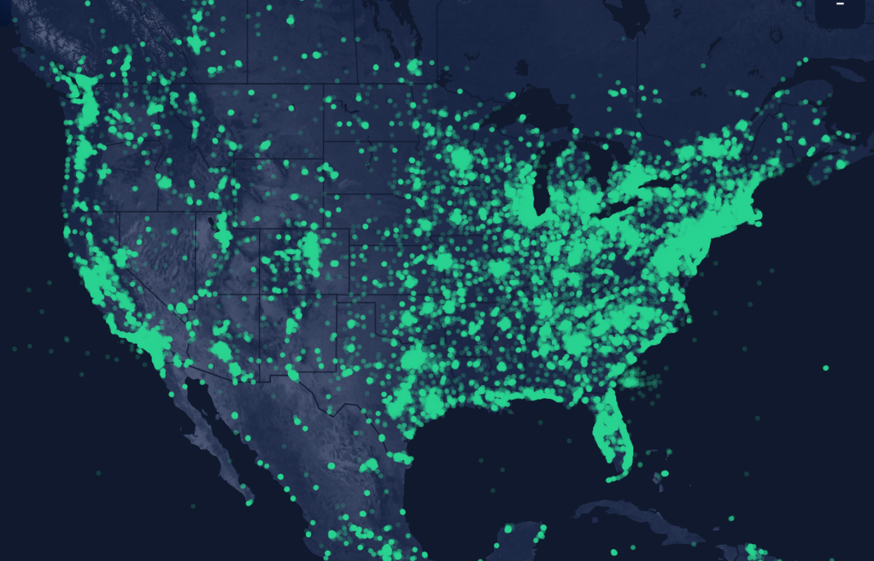
The hexes that are shown on the Helium mapper have been validated in the real-world via physical GPS validation and provide the most accurate representation of the coverage that exists within the Helium network. This is an important resource that allows to make better decisions when considering using OpenTrak for specific user applications.
The geography area where a tracking application is planned to be used with the OpenTrak should always be pre-validated to have the coverage through the Helium Mapper.
If the geographical area you are planning to carry out a tracking application using OpenTrak has not been validated in the Halium Mapper, it might be best to validate the mapping yourself if your application is important.